
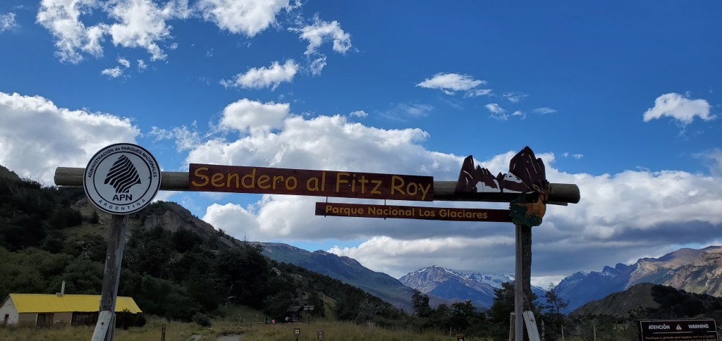
I had read that the Mount Fitz Roy hike in El Chalten was very difficult. I may have neglected to tell the rest of the family….
We woke up at around 8:45, had a quick breakfast, and took a taxi 30 minutes to the Hostería El Pilar. Normally, hikers start in El Chalten and go there and back. But, our host told us about the El Pilar path, which is “easier,” slightly shorter, and point-to-point rather than a back-and-forth (meaning more gorgeous and different views). The only downside is the 30-minute ride to get to the start, which isn’t much of a downside as the car ride scenery is stunning as well.

We thanked our taxi driver and started on the hike. Patagonia is known to be windy, and it certainly was. The first 30 minutes was relatively flat and we even crossed a couple of creeks.
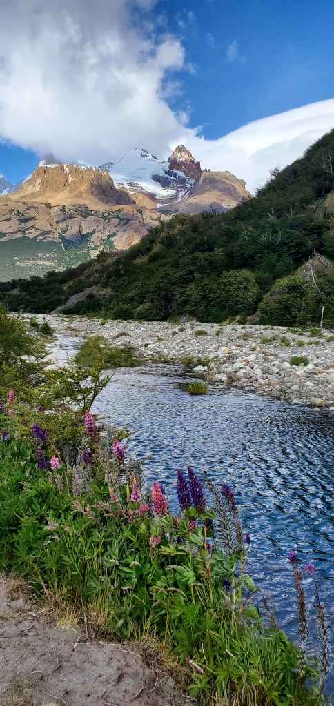
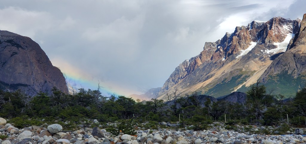
In the distance, we spotted a rainbow.
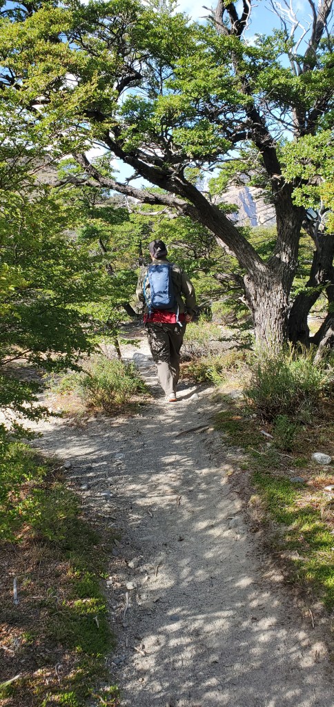
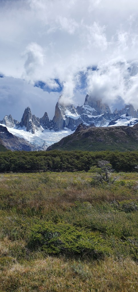
The next couple of hours was a gradual uphill, with the occasional view of Mount Fitz Roy peeking through the forest. Luckily, it was mostly sunny.
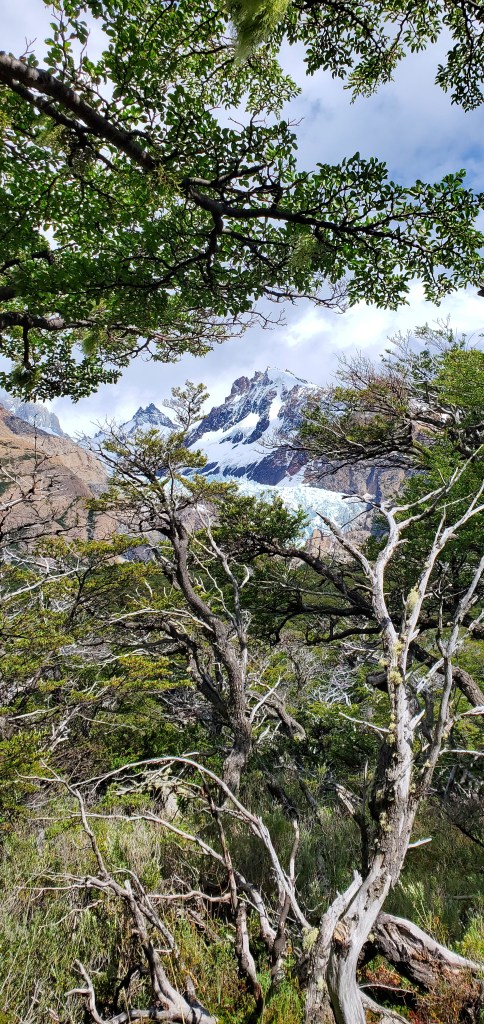


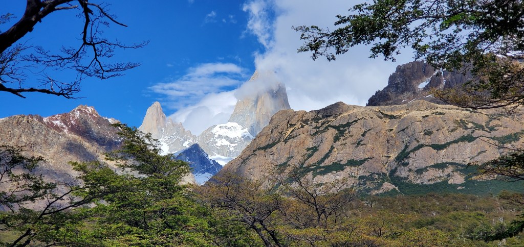
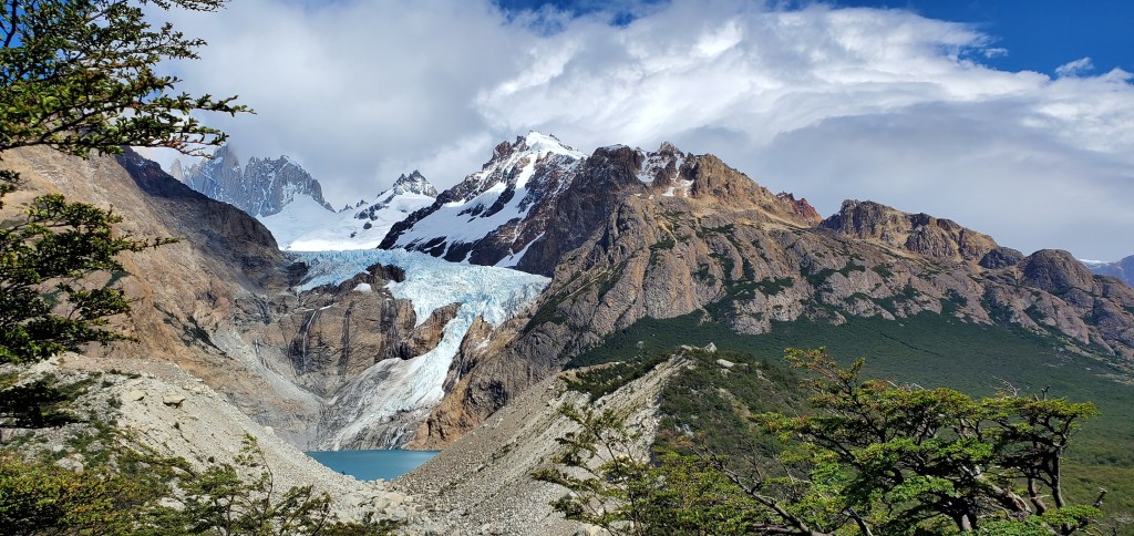
After 2 kilometers, we stopped at the viewpoint for the Piedras Blancas Glacier and Lagoon. It was pretty but not as cool as the Huemul Glacier (which we got to see much closer).


We kept hiking until the crossroads, with one trail leading to El Chalten, and the other leading to Laguna de Los Tres and Fitz Roy.


Asher and I quickly powered ahead of our parents, since they are a *little* bit slow. After the crossroads, there was around 1 kilometer of flat, and we crossed a nice bridge over the Rio Blanco. It was at the bridge where the popularity of the trail hit us. Signs instructed one person at a time to cross the bridge, and crowds quickly piled up on either side as people crossed (some pausing to take pictures, slowing everything down even more).


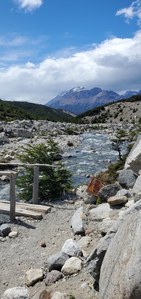

Even before the bridge, there was a campsite that was filled with a minimum of 50 tents.

The last kilometer+ (labeled as a kilometer, felt like much more) to the lagoon was very, very, very steep. It was close to straight uphill and to make it worse, there were plenty of loose rocks, gravel/sand, random crevices from erosion, and lots of switchbacks with high, narrow, and irregular stone steps. To add to the difficulty, there were many people heading back down, people stopped to rest, and people who wanted to go faster and pass. There were numerous signs urging people to stick to the official trail, but with so many people, the official trail was usually the most eroded and hardest to walk on. Not to mention, half the people ignored the signs and just went whatever way they thought was the best.

It was definitely a real slog. We needed to pay attention to the ground so we didn’t fall, the sun was beating straight down (no tree cover), the beautiful view was to our backs, we were low on water, and we were trying to go relatively fast so we could make it back in time to meet our taxi driver.

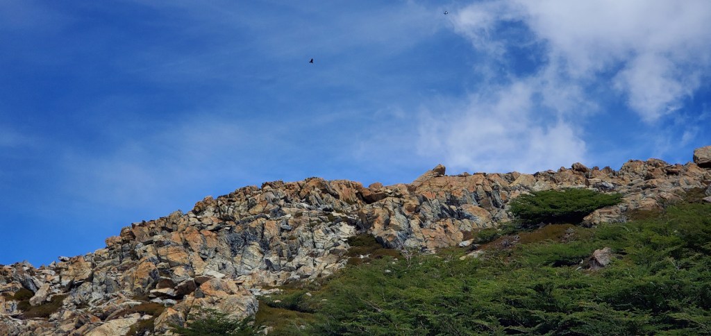
Even though there were no clouds in sight, it randomly sprinkled a little bit, though not enough to warrant taking out the ponchos. On the way up, Asher and I spotted what we think were a few Andean condors.
Hoping we would be greeted with the lagoon at the top of the uphill, Asher and I scrambled up the last section, only to be severely disappointed. Just when you think you’ve finished climbing, there is one more small-ish, sandy hill to climb.
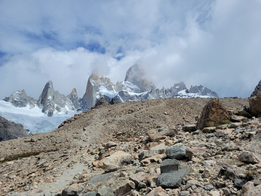
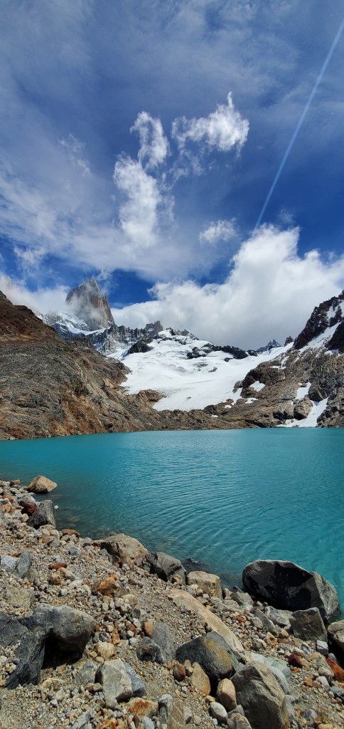
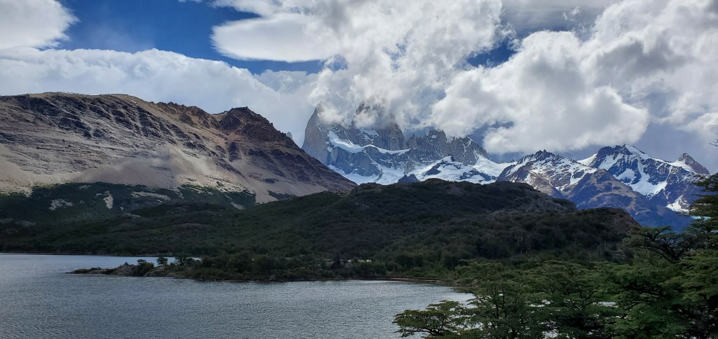
After non-stop complaining, we reached the crest of the final hill and were presented with an amazing view of Fitz Roy and the brilliant blue lagoon in front of it.

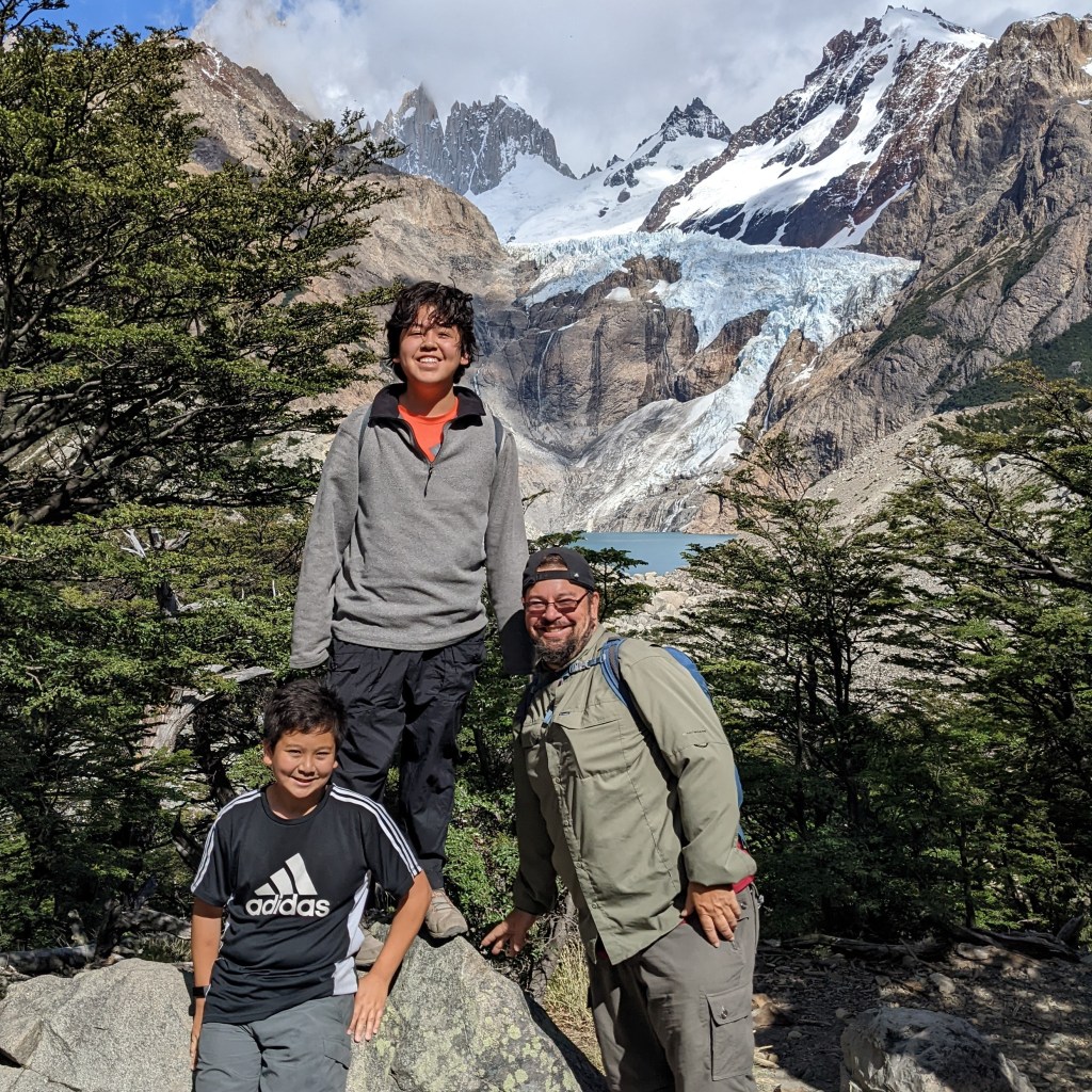
We waited a while for our parents while soaking in the beauty and scenery. Once they got there, we had the lunch our mom brought and took plenty of pictures.


Knowing he would have trouble on the downhill, my dad started back down. Asher, my mom, and I went down to the lagoon, took pictures, and even saw an adorable little Andean fox!


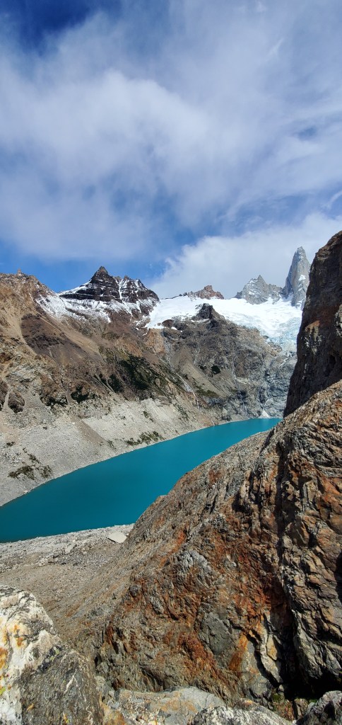
Asher and my mom, being slower than me, headed back while I explored the area a bit more. I walked about 5 minutes more along the edge of the lagoon to an additional vista that looked straight down to a different, much lower, but still bright blue lagoon.


The way back down wasn’t too bad, but there were some sections that were steep and sandy, which was a little scary. I caught up to Asher and my mom around two-thirds of the way back down. We filled up our water bottles at the river since all the glacier water is potable (and ice-cold!).


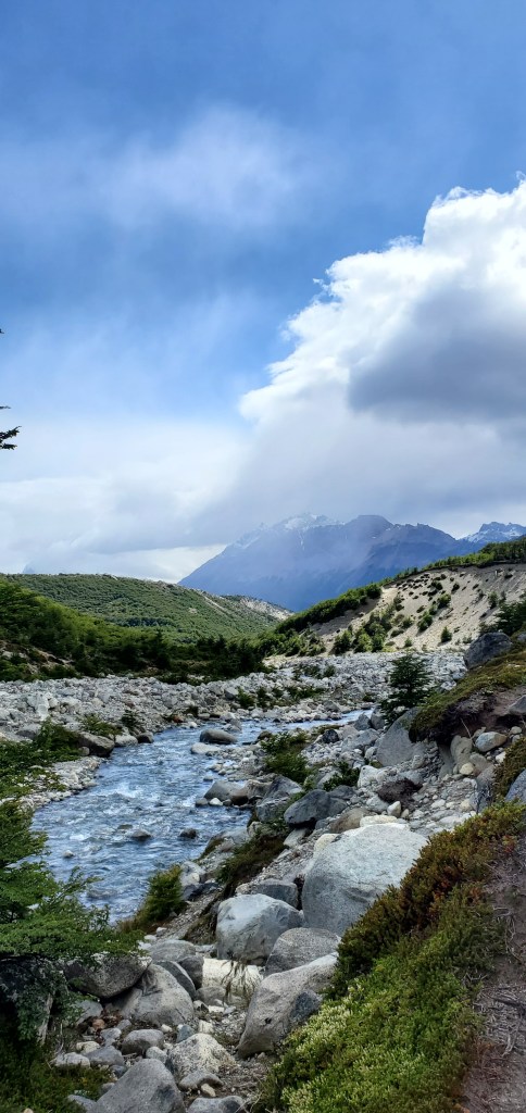
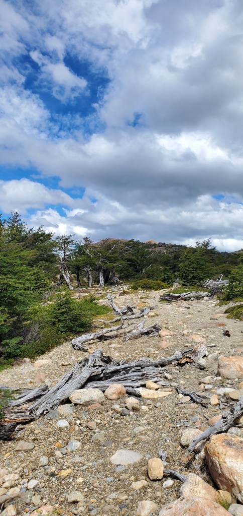
We got to the crossroads and headed towards El Chalten with views of Fitz Roy behind us the whole way back. It was pretty much flat and we passed through forest, marsh, and scrubland.


We set a pretty good pace, around 4km/hour. We made it to a junction with two paths, one to a viewpoint of Fitz Roy, the other Laguna Capri.
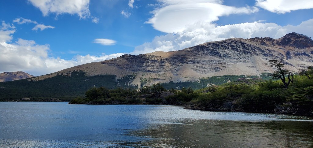
We went right to the lagoon, where we were rewarded with views of Fitz Roy behind the stunning lagoon.
We finally caught up with my dad at the lagoon, and I even spent some time “gazing into the distance” at Fitzroy.


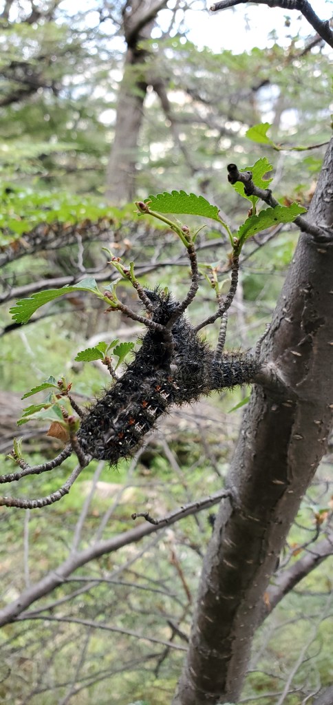
We hiked around 2 km of flat and then we began a descent into El Chalten. We even passed a section where all the trees and bushes were covered in these cool-looking spiky caterpillars.

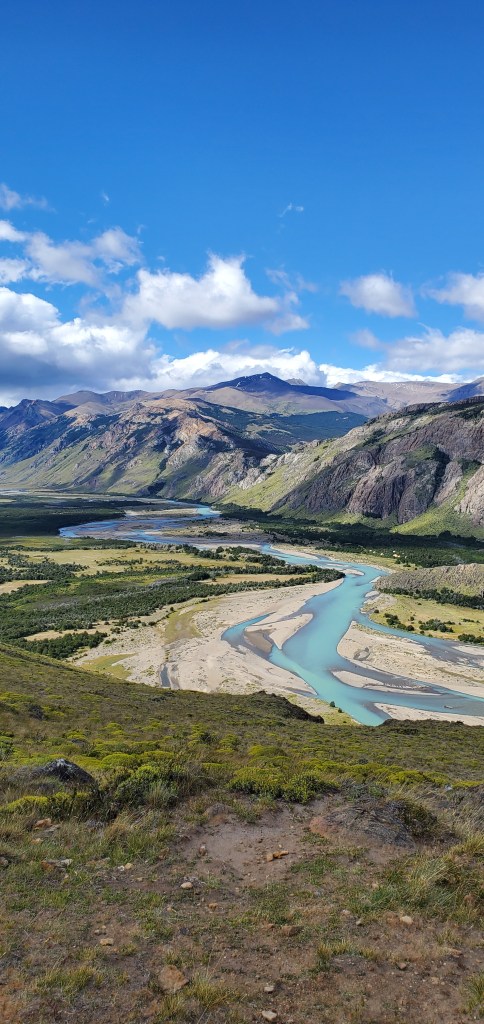
We had views of the blue-purple Rio Blanco to our left as we descended.


We finally made it to the bottom on time, grabbed dinner and our bags before heading back to El Calafate.
By the end, we had hiked around 10 hours, a total of about 16 miles, and according to Asher’s Fitbit – 47,000 steps. Asher, my mom, and my dad all say no more long, tough, poor beauty-to-effort hikes. As for me, I can’t wait for another awesome, long hike!

I loved these images. It was so much what I wanted for our family. I so glad you got a chance at it! What a great experience. I’m envious.
LikeLike